What is the Integrated Hydrologic Model?
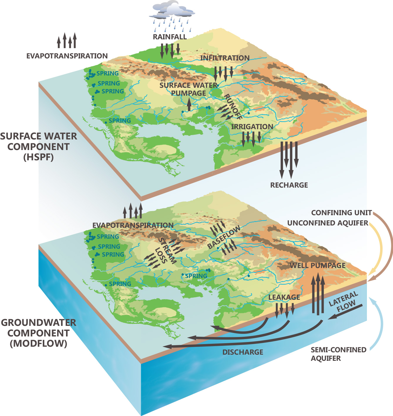
The Integrated Hydrologic Model (IHM) is a powerful computing tool that is designed to simulate all surface and subsurface processes of the hydrologic cycle and their dynamic interactions within a Windows operating system environment. The IHM couples two well established and broadly used model codes to simulate hydrologic processes: Hydrologic Simulation Program–FORTRAN (HSPF) to simulate surface and vadose zone processes and MODFLOW to simulate saturated groundwater processes. IHM simulations have durations ranging between 1 day to many years or decades and model domains ranging from 0.01 to 10,000 square miles. The IHM represents the third generation of HSPF–MODFLOW coupling which was first developed in the late 1980s and is the product of a collaborative effort between Tampa Bay Water and the Southwest Florida Water Management District.

Subscribe to our mailing list
Announcements
Through mass-conserving custom integration code, the IHM simulation engine dynamically couples hydrologic processes simulated by HSPF and MODFLOW to represent the hydrologic interaction of uplands and water bodies with the groundwater system. HSPF and MODFLOW are dynamically coupled by eleven IHM integration paths which govern surface-subsurface interactions for:
- Vadose zone storage and moisture
- Infiltration with transition to saturation-excess
- Evaporation from bare soil and vegetated surfaces when the capillary zone intersects land surface
- Evaporation from water bodies
- Vegetation-dependent evapotranspiration from uplands and moisture-limited water bodies
- Recharge
- Flow exchange between water bodies and ground water
- Temporally-variable specific yield
What are some applications for the integrated hydrologic model?
The Integrated Hydrologic Model (IHM) can provide unique insights into the inter-relationships for the climate-land-water system and how climate and anthropogenic factors can influence hydrologic responses within that system. The IHM is well-suited to landscapes that exhibit near-surface water table conditions where hydrologic processes of pervious land interact between surface, vadose, and saturated groundwater systems. The IHM is also well-suited to hydrologic conditions exhibiting active flow exchange between water bodies and the groundwater system.

The IHM can help water and land managers, water utility operators, and industry with decision support related to water and land management, water supply planning and operations, regulation development, permitting, and regulation compliance assessments. IHM output can be used with other software to provide optimized solutions for the model parameter space and for decision support.
What is the Integrated Northern Tampa Bay Model?
Model practitioners are interested in successful examples of model applications developed for a model code like the Integrated Hydrologic Model (IHM). The Integrated Northern Tampa Bay (INTB) model is a calibrated model application of the IHM code. The INTB model covers 4,000 sqmi of the Tampa Bay region. The calibration and verification periods include 10 and 8 years, respectively, of widely varying rainfall and pumping conditions. The Tampa Bay region includes large areas dominated by near-surface water table and high density water bodies. The INTB model has provided broad decision support for a hydrologic system which displays dynamic hydrologic interaction among uplands, water bodies, and the groundwater system. Development and calibration of the INTB model was a joint effort of Tampa Bay Water and the Southwest Florida Water Management District.
More about the Integrated Hydrologic Model
Within each IHM sequential or asynchronous integration cycle, all processes are simulated by HSPF and MODFLOW. IHM transfers flux and storage between HSPF and MODFLOW and dynamically updates model parameters that are influenced by IHM integration paths. MS Access databases are used extensively by the IHM.
The surface landscape is spatially discretized using hydrologic response units. IHM fragments, a topological overlay of HSPF irregular polygon simulation units and MODFLOW grid cells, are used to facilitate spatial integration. HSPF and MODFLOW computational time steps are physically based and smaller than the IHM integration cycle.
Many input properties to an IHM simulation are shared among multiple model parameters. Some input properties support model parameters for both HSPF and MODFLOW. Automated preprocessing of the IHM provides a repeatable process to generate many model parameters.
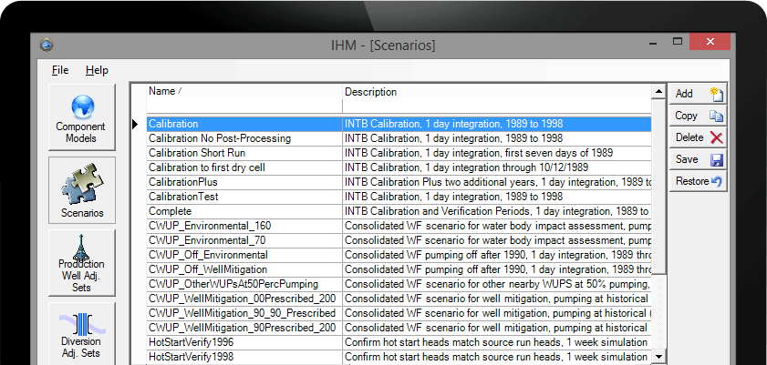
Tabular and graphical summaries of IHM simulation output can be produced by several postprocessing plugins. Output can be linked to GIS shapefiles for map displays and spatial analysis. A water balance plugin is included. Another plugin prepares hotstart initial conditions for a simulation.
The IHM source and executable codes and its documentation have been externally peer reviewed by a nationally recognized team of model developers and users. The Integrated Northern Tampa Bay (INTB) model, a 4,000 sqmi calibrated model application developed with the IHM for the Tampa Bay region, has also been peer reviewed by the same team.
IHM developers use a free for use, collaborative development environment. Consent to the free for use End User License agreement (EULA) grants users the ability to download IHM executable code and to download and modify IHM source code for individual editing and advanced modeling. By making the source code available the development team hopes to foster outside collaboration with modelers and developers. Open feedback is encouraged from all users of the IHM. Documented and validated code change submissions will be reviewed for inclusion into a later version of the IHM. This information does not supersede the text of the EULA. Send feedback and code submissions to our development team.

